
Only Cried Once Today
- Deborah Kade
- Mar 25
- 7 min read


Today we left Seoul for the DMZ as Michael was interested in going there. We left our driver in Paju and boarded a special bus that took us on the tour of the DMZ.
The first stop had us being close to the peace bell. Michael thought it would be memorable to actually ring the bell.
The Peace Bell (Pyeonghwauijong) at Imjingak Pyeonghoa-Nuri Park in Paju, South Korea, built in 2000, symbolizes hopes for national reunification and world peace. Located near the DMZ, the 21-ton bell is housed in a pavilion and rung to pray for peace. It is a significant tourist site near the Freedom Bridge.

The coordinates for the peace bell are in South Korea, very near the North Korean border.
My point:
Latitude: 37° 53′ 25.878″ N
Longitude: 126° 44′ 23.028″ E
The Korean Demilitarized Zone (DMZ) is a 4 km wide buffer zone straddling the Military Demarcation Line (MDL). At that longitude, the MDL runs roughly along latitude 37° 56′ N.
My latitude is 37°53′ 25.878″ N, so I'm about: Difference in latitude: ~2.57 minutes of arc ≈ 4.8 km south of the MDL.
Since the DMZ extends roughly 2 km north and 2 km south of the MDL, that means:
I am just outside the southern edge of the DMZ.
Distance to the nearest edge of the DMZ is roughly 2–3 km.
Distance to the central MDL line is roughly 4–5 km.
So: I am only a few kilometers from the DMZ—very close to the border zone.


Key Details About the Peace Bell:
Location: Imjingak Pyeonghoa-Nuri Park in Paju, Gyeonggi-do.
Purpose: Built in 2000 to pray for the peace of the human race and the unification of North and South Korea.
Symbolism: The bell weighs 21 tons and has 21 steps, symbolizing the 21st century.
Structure: It is housed within a traditional pavilion known as the Peace Bell Pavilion.
Significance: It is part of a larger complex, including the Freedom Bridge and the Hill of Wind, that highlights the history of the Korean War and hopes for the future.

For me, it was quite emotional and I cried. Wouldn't it be wonderful if we were in a period of peace around the world.


Stones of Peace Wall
"The sculpture is made from stones collected from battlefields all over the world that have witnessed the suffering and grief of war."


Number 51 The Revolutionary war, United States, Massachusetts


Farming in this area. These fields are rice paddies. Rice paddies are flooded parcels of arable land or terraced fields used for growing semiaquatic rice. Bordered by earthen bunds, they are kept flooded for most of the growing season, which helps control weeds and pests. These fields are vital for agriculture, producing staple food while sometimes integrating fish or ducks to improve sustainability.


Once we drove over the blue line we were in the DMZ.

The Korean Demilitarized Zone (DMZ) is a 250-kilometer-long (160 miles) and 4-kilometer-wide (2.5 miles) border barrier, established in 1953 to separate North and South Korea. Despite its name, it is one of the world's most heavily militarized areas, acting as a fortified buffer zone and the final, enduring border of the Cold War.
AI Overview
The Korean Demilitarized Zone (DMZ) is a 250-kilometer-long (160 miles) and 4-kilometer-wide (2.5 miles) border barrier, established in 1953 to separate North and South Korea. Despite its name, it is one of the world's most heavily militarized areas, acting as a fortified buffer zone and the final, enduring border of the Cold War.
Key Details About the Korean DMZ:
Establishment: It was created on July 27, 1953, under the Korean Armistice Agreement between North Korea, China, and the United Nations Command to end active fighting in the Korean War.
Location: The DMZ runs across the Korean Peninsula, roughly along the 38th parallel north, which was the original division line after World War II, according to Wikipedia and Liberty in North Korea. It is roughly 50-60 km from Seoul, South Korea.
Purpose: The zone was designed as a buffer to prevent further military conflict and to manage the repatriation of prisoners of war, as described by Wikipedia and Britannica.
The Joint Security Area (JSA): Located in the village of Panmunjom, this is the only part of the DMZ where North and South Korean forces stand face-to-face, according to EBSCO Research Starters and Korea Konsult.
Wildlife Haven: Due to the lack of human development for over 70 years, the area has unexpectedly become an ecological refuge for rare and endangered species, say EBSCO Research Starters.
Tourism: Despite the military tension, parts of the DMZ are open to tourism from the South Korean side, allowing visitors to view the border.
We spent 50 minutes exploring this area.

We watched a short film at the third tunnels location.


Michael was living in Seoul in 1976 and he remembers the ax murders.


Discovering tunnels


This area is the location of the third tunnel that was found.


You can actually go down into the third tunnel but opted out.

Landmine warnings!!!!!

Next stop was Mount Dora

From here, we could look across to North Korea but we were not allowed to take pictures as it is a military installation.
Now, this little community, Paju DMZ Village, is quite an interesting place.
They do not pay taxes because they live so close to the DMZ and North Korea.
If you are single, the woman approaches the man and says. "I am interested in you." If the man agrees, they live together for sixty days. After that time, they either stay together or separate and go their own way. She may try again in a year.
There is a curfew for the community from 10 PM until 5 AM. Also, a patrol comes in and checks to see if the people present matches the number that should be living there. Don't know the answer if it isn't.


We had a 15 minute stop here.


Yes, we tasted this traditional liqueur. Well, it is to wish for peace. Michael and I have tasted makgeolli back home. It is quite strong.


Back with out driver, we stopped at Imjingak which is a park located on the banks of the Imjin River along the tracks of the former Gyeongui Train Lin outside the city of Paju. The park has many statues and monuments regarding the Korean War. There is also a restaurant, an observation deck, a pool in the shape of the Korean peninsula, and even a small amusement park.
The park was built in 1972 to console those from both sides who are unable to return to their hometowns, friends and families because of the division of Korea.
Imjingak is where the "Freedom Bridge" lies. Crossing the Imjin river, it is a former railroad bridge which was used by repatriated POW soldiers returning from the North. It is more famous, however, for serving until 1998 as the only point of egress from South Korea onto the DMZ, other than Liberty Bridge (which was controlled by the South Korean Army), and the only direct link to Camp Greaves, Liberty Bell, and Panmunjom. This is not to be confused with the "bridge of freedom" which is merely an access bridge to the main span that allowed the one-way southbound traffic to pass by while northbound traffic stood waiting its turn to cross; it now crosses a stream adjacent to the Imjin river and connects with the North-South railway.
Mangbaeddan is a memorial, which enables displaced people whose hometowns are located within North Korea to bow down to their parents or family in North Korea as a sign of respect during cultural events such as New Years and Chuseok (the Korean Mid Autumn Festival, which usually entails paying respect to your elders and ancestors). This memorial holds many sorrowful memories of separated families during the Korean War.


The last train to cross the border between North and South Korea, a military transport delivering supplies to UN forces following MacArthur's inland push in 1950, became stuck at Hanpo Station in Hwanghe-do in what is now North Korea on December 31, 1950 due to Chinese troops ahead. Unable to turn around, the conductor attempted to back the train back down to Munsan but was stopped by US troops who decided that rather than risk the train falling into North Korean hands, were ordered to destroy the train. The locomotive was a KNR Mateo1 Class.


The rusted, bullet-riddled, and shell-riddled locomotive can be found in the park at Imjingak, near the destroyed Dokgae Railroad Bridge that crosses the Imjin River. In 2004 the rusted locomotive was registered as a Cultural Heritage site and is a visual reminder of the length of time the border has been closed in the hope trains will once again cross freely.
Had a late lunch here. Food was especially tasty!


We were served Sikhye, a sweet rice punch while we looked over the menu. This is a fermented beverage made by fermenting rice with malt. Unlike cinnamon punch, it has a strong sweet flavor that is well-loved by many people. Mainly consumed at parties or holidays, the malt containing digestive enzymes will soothe your stomach.

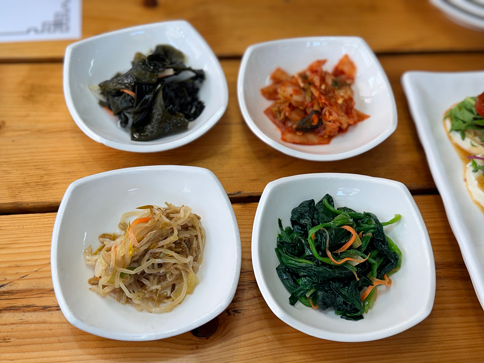
Our meals came with rice and side dishes.

This was extraordinary!!!!!!

Michael had the spiciest. He was red in the face.

Amazing flavor to this bibimbap


June had the least spicy one.

I was shocked to see my favorite movie studio, Studio Dragon, so close to the restaurant.

I counted 13 different sets. Looks like more will be coming.


The final stop of the day was at Odusan Unification Observatory. The observatory is situated in the northernmost ceasefire line of the western front where the Hangang River and Imjingang River meet. It offers a wide view of Songaksan Mountain in Gaeseong to the north and 63 Building in Seoul to the south. Also, it is a valuable unification security tourist attraction related to Imjingak, the 3rd Tunnel, and Panmunjeom (Joint Security Area) stretching along Jayu-ro Road in the northeast.
Since its opening, almost 1,900,000 people have visited the observatory to feel the reality of the division, making this area the best national unification education site.
The Odusan Observatory is the closest place from Seoul, from which you can observe North Korea without having to book a tour or go through security screening.
The observatory sits atop a hill where the Han and Imjin rivers meet. It offers a beautiful view of the North Korean village of Maegon and its “Tower of Immortality,” which every North Korean municipality is required to erect in memory of the eternal President Kim Il Sung and the great leader Kim Jong Il.
From time to time, North Korean farmers can be seen working in the surrounding fields. North Korean propaganda broadcasts can also be heard over loudspeakers.
We actually saw two people walking plus smoke from something being burned.
It is located about 2 kilometers from the North Korean side of the river. Telescopes are available and free of charge.
I took some pictures with Michael's phone so I will include more at a later time.

Another wonderful day comes to a close.June certainly knows how to plan a tour!


I think I would have cried with you too, I could feel the vibration from the bell . So many interesting places . June is definitely upping the anti on getting your steps in .xox