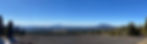
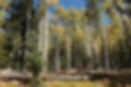
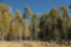
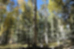
Aspen Corner area at Snowbowl, Arizona
- Deborah Kade
- Oct 16, 2021
- 1 min read
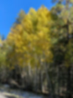
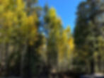
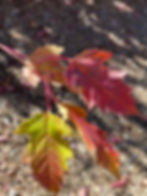
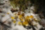
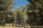
Michael and I are spending the weekend in Flagstaff, Arizona, as I was hoping to photograph some Fall colors. Unfortunately, it snowed here last weekend and the Fall colors are now past peak. Oh, well....we still had fun walking through the woods. There were still patches of snow which made for some interesting pictures. We had a wonderful time!

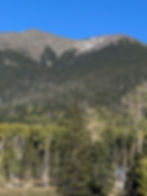
Drove 7 miles (11 km) from Flagstaff to Snowbowl. Snowbowl is located on the western slope of Mount Humphreys, the tallest point in the state. Humphreys is the most recognizable point on the San Francisco Peaks, which are north of Flagstaff. “The Peaks,” as they are often known, are what remains of an eroded, dormant stratovolcano that was formed between 500,000 and 1,000,000 years ago. The Snowbowl ski area covers approximately one percent of the San Francisco Peaks, and its slopes face west and northwest.
Mountain Stats:
Base elevation: 9,200 feet (2800 meters) Lift served elevation: 11,500 feet (3505 meters) Hike-to elevation: 12,000 feet (3657 meters) Total vertical rise: 2,800 feet (853 meters) Skiable acres: 777 Runs: 55 (22% beginner, 43% intermediate, 22% advanced, 13% expert runs); longest is 2 miles Lifts: 8 (one high-speed detachable combination lift, one high-speed six person chairlift, four fixed-grip chairlifts and two surface conveyors) Average season: mid-November through the end of April Average snowfall: 260 inches (6.6 meters)
Many families out enjoying the beautiful day and taking family photographs.
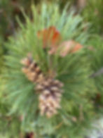


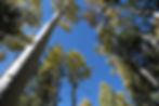


Sap running from a pine tree. Smelled like a Christmas tree! Ahhh.....