
Mt. Rainier, Washington
- Deborah Kade
- Aug 12, 2018
- 14 min read

Monday, August 6, 2018

On Sunday evening, when we checked into our hotel, the Motif Seattle, I noticed a brochure for a tour of Mt. Rainier. As Michael had meetings all day Monday, I decided to book the tour with our hotel concierge.
So, I took the Mt. Rainier Tour by Customized Tours. If you are in Seattle and do not have a car, I would highly recommend this tour. Our tour guide, Joel M, was outstanding!!! I learned so many new things!
ToursOfSeattle.com | reservations@toursofseattle.com
(toll free) 888.554.8687
(local) 206.878.3965

With a 7:40 AM pickup at my hotel, my 12 hour adventure began.
Our first stop was at the FredMeyer grocery store in Puyallup for a restroom break and also an opportunity to buy food for lunch. Joel also told us about dining opportunities that were available in the park.
The next stop was at the entrance to the park for a photo opportunity.

Mount Rainier National Park is the nation's fifth oldest national park and one of 417 national treasures cared for and held in trust for the American people by the National Park Service. National parks are preserved and protected for the enjoyment of you and your children's children. This area has spectacular subalpine, wildflower meadows, lowland old growth forests and dramatic glacial and geological features. The wildlife, historic buildings, cultural history, 275 miles of trails and natural resources are all here for everyone to enjoy.
Mt. Rainier is the highest mountain of the Cascade Range of the Pacific Northwest, and the highest mountain in the U.S. state of Washington. It is a large active stratovolcano located 59 miles (95 km) south-southeast of Seattle, in the Mount Rainier National Park. It is the most topographically prominent mountain in the contiguous United States and the Cascade Volcanic Arc, with a summit elevation of 14,411 ft (4,392 m).
Mt. Rainier is considered one of the most dangerous volcanoes in the world, and it is on the Decade Volcano list (16 volcanoes identified by the International Association of Volcanology and Chemistry of the Earth's Interior (IAVCEI) as being worthy of particular study in light of their history of large, destructive eruptions and proximity to populated areas.) Because of its large amount of glacial ice, Mt. Rainier could produce massive lahars (a violent type of mud flow or debris flow composed of a slurry of pyroclastic material, rocky debris and water. The material flows down from a volcano, typically along a river valley) that could threaten the entire Puyallup River Valley, and poses a grave threat to the southern sections of the 3.7-million-resident Seattle metropolitan area.
Mount Rainier was first known by the local Salishan speakers as Talol, or Tacoma or Tahoma. One hypothesis of the word origin is ("mother of waters"), in the Lushootseed language spoken by the Puyallup people. Another hypothesis is that "Tacoma" means "larger than Mount Baker" in Lushootseed: "Ta", larger, plus "Koma (Kulshan)", Mount Baker. Other names originally used include Tahoma, Tacobeh, and Pooskaus.
The current name was given by George Vancouver, who named it in honor of his friend, Rear Admiral Peter Rainier. The map of the Lewis and Clark expedition of 1804-1806 refers to it as "Mt. Regniere".
Although "Rainier" had been considered the official name of the mountain, Theodore Winthrop, in his posthumously published 1862 travel book The Canoe and the Saddle, referred to the mountain as "Tacoma" and for a time, both names were used interchangeably, although "Mt. Tacoma" was preferred in the city of Tacoma.
In 1890, the United States Board on Geographic Names declared that the mountain would be known as "Rainier". Following this in 1897, the Pacific Forest Reserve became the Mount Rainier Forest Reserve, and the national park was established three years later. Despite this, there was still a movement to change the mountain's name to "Tacoma" and Congress was still considering a resolution to change the name as late as 1924.
In the lead-up to Super Bowl XLVIII, the Washington State Senate passed a resolution on Friday, January 31, 2014, temporarily renaming the mountain Mount Seattle Seahawks until the midnight after the Super Bowl, Monday, February 3, 2014, in response to the renaming of 53 mountains in Colorado after the 53 members of the Denver Broncos by Governor of Colorado John Hickenlooper.
Mount Rainier is the tallest mountain in Washington and the Cascade Range. This peak is located just east of Eatonville and just southeast of Seattle and Tacoma. Mount Rainier is ranked third of the 128 ultra-prominent mountain peaks of the United States. Mount Rainier has a topographic prominence of 13,210 ft (4,026 m), which is greater than that of K2, the world's second-tallest mountain, at 13,189 ft (4,020 m). On clear days it dominates the southeastern horizon in most of the Seattle-Tacoma metropolitan area to such an extent that locals sometimes refer to it simply as "the Mountain." On days of exceptional clarity, it can also be seen from as far away as Corvallis, Oregon, (at Marys Peak) and Victoria, British Columbia.
With 26 major glaciers and 36 sq mi (93 km2) of permanent snowfields and glaciers, Mount Rainier is the most heavily glaciated peak in the lower 48 states. The summit is topped by two volcanic craters, each more than 1,000 ft (300 m) in diameter, with the larger east crater overlapping the west crater. Geothermal heat from the volcano keeps areas of both crater rims free of snow and ice, and has formed the world's largest volcanic glacier cave network within the ice-filled craters, with nearly 2 mi (3.2 km) of passages. A small crater lake about 130 by 30 ft (39.6 by 9.1 m) in size and 16 ft (5 m) deep, the highest in North America with a surface elevation of 14,203 ft (4,329 m), occupies the lowest portion of the west crater below more than 100 ft (30 m) of ice and is accessible only via the caves.
The Carbon, Puyallup, Mowich, Nisqually, and Cowlitz Rivers begin at eponymous glaciers of Mount Rainier. The sources of the White River are Winthrop, Emmons, and Fryingpan Glaciers. The White, Carbon, and Mowich join the Puyallup River, which discharges into Commencement Bay at Tacoma; the Nisqually empties into Puget Sound east of Lacey; and the Cowlitz joins the Columbia River between Kelso and Longview.
The broad top of Mount Rainier contains three named summits. The highest is called the Columbia Crest. The second highest summit is Point Success, 14,158 ft (4,315 m), at the southern edge of the summit plateau, atop the ridge known as Success Cleaver. It has a topographic prominence of about 138 ft (42 m), so it is not considered a separate peak. The lowest of the three summits is Liberty Cap, 14,112 ft (4,301 m), at the northwestern edge, which overlooks Liberty Ridge, the Sunset Amphitheater, and the dramatic Willis Wall. Liberty Cap has a prominence of 492 ft (150 m), and so would qualify as a separate peak under most strictly prominence-based rules. A prominence cutoff of 400 ft (122 m) is commonly used in Washington state.
High on the eastern flank of Mount Rainier is a peak known as Little Tahoma Peak, 11,138 ft (3,395 m), an eroded remnant of the earlier, much higher, Mount Rainier. It has a prominence of 858 ft (262 m), and it is almost never climbed in direct conjunction with Columbia Crest, so it is usually considered a separate peak. If considered separately from Mt. Rainier, Little Tahoma Peak would be the third highest mountain peak in Washington.
Longmire was the next stop.
Log framing, rough lapped wood siding and cedar shake roofs are important elements of the National Park Service rustic style. Boulder foundations and stone chimneys are also key characteristics.
Longmire Administration Building

Longmire Service Station
It has not always been easy to get to Mt. Rainier. Early visitors reached the park by horse or carriage over rough, often muddy, roads. Improved roads and the arrival of the first automobile in 1907 simplified access to the mountain experience. In fact. Mt. Rainier was selected as the first national park to experiment with automobile access.
This building, constructed in 1929, was essential to those early motorists. it had gas pumps styled in the manner of the time period, with a sheltered bay connecting to a sales and information office. The second floor contains an apartment reached by a rear staircase.
Today, the service station portrays the history of travel in the park, and serves as an example of the National Park Service's rustic style of architecture.

Longmire Museum
Many of the structures at Longmire have changed in purpose and location over the decades and this building, one of the park's oldest, is one of those.
Built in 1916, it first served as park headquarters and was located across the street where the present Administration Building stands. By 1928, the park superintendent was set to demolish it until Chief Naturalist C. frank Brockman convinced him to save it for a museum. Brockman created the museum exhibits, some of which are still in use today.
The structure moved to this location in 1978 and serves both as a museum and a historical exhibit in and of itself. For decades, visitors have stopped here to learn about the park and its resources.

National Park Inn
This hotel has accommodated generations of visitors since 1917, although its name, ownership and even location have changed throughout time. It succeeded an earlier National Park Inn, built by a partnership of railroads in 1906 in competition with the Longmire Springs Hotel nearby. Ironically, the current Inn was built as an annex of the Longmire Springs Hotel in the meadow across the road.
By 1918, a company bought all three buildings and moved the Longmire Springs Hotel annex beside the National Park Inn. Fatefully, in 1926, fire destroyed the first National Park Inn and the annex assumed its name.
Today, as in the past, the Inn's wide porch offers visitors a grand view of Mt. Rainier and twenty-five guest rooms provide rest for travelers.


Douglas Fir


Christine Falls
Christine Falls are some of the prettiest and most easily accessible falls in the park. This signature view of the lower falls is framed by the historic, arching Christine Falls Bridge. The falls drop 69 feet in drops of 32 and 37 feet respectively and are notorious for being nearly impossible to photograph together.


Trees with moss


So much water flowing from the rocks

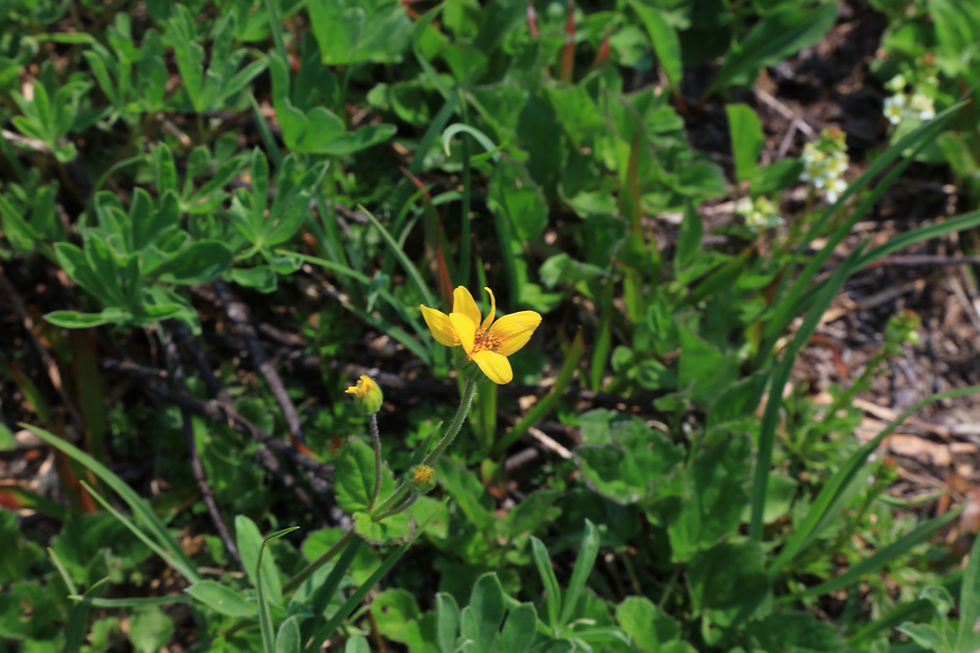
Subalpine daisy

U shaped glacier canyon

This was our next stop. Joel treated us to cupcakes (purchased them at FredMeyer) while we took in the scenery. Cold water was also available to us throughout the trip.

My thoughts of this view were: spiritual, soul quenching, magical, WOW, amazing.........
Inspiration Point


Opposite view

We stopped at Reflection Lakes. The wind kicked up so the reflection wasn't great but you can still make it out. Many fish jumping out of the water.


Next stop...Paradise. We were given about two and a half hours to explore the area around Paradise.
Mount Rainier National Parks busiest and most dramatic visitor center, the aptly named Paradise is rightfully the parks classic showcase. It was back in the late 1800s when park pioneer James Longmires daughter-in-law, Martha, proclaimed upon reaching this mile high flower-studded valley, “Oh, what a paradise!” And those same words have been uttered since by millions of others after they visited this spectacular subalpine vale.
Nestled on the south slopes of the glacier-shrouded volcano at an elevation of 5,400-feet among wildflower meadows punctuated with glistening snowfields and groves of gnarled firs and hemlocks; there are few locations within the entire national park system this stunning. Getting to Paradise is easy; just follow the main park road eleven miles east beyond Longmire. Aside from its breathtaking scenery and role as a portal into the surrounding wilderness, park visitors will find a wide array of services and activities at Paradise.
Started my hike at the new Henry M. Jackson Memorial Visitor Center, named in honor of one of Washington's longest serving and most influential senators. Opened in 2008 at a cost exceeding $21 million, the center is smaller and more energy efficient than the one it replaced and blends in better with the surrounding environment. The old 1960s built center with its futuristic look which many visitors likened to a flying saucer, was a concrete behemoth requiring tens of thousands of gallons of diesel fuel to heat each year. The new centers architecture is truer to the areas historic and natural setting.
Entered through large fir and cedar doors to a warm and well lit interior. Gazed out through massive windows north to the hulking mountain and south to the serrated Tatoosh Range. Enjoy displays on the mountains flora and fauna and learn how these species survive in such a harsh and snowy environment. I also checked out the centers intriguing mountain climbing exhibit and geology displays. I did not have time to catch a short film on the park at the small theater also housed within the center.
You can also find a cafeteria, book and gift shop, information booth, and guided ranger programs at the new center. The Henry M. Jackson Memorial Visitor Center at Paradise is open daily from mid-May through early October, and on weekends the rest of the year.


Situated next to the center is the historic Paradise Inn, offering lodging and dining in undoubtedly one of the most superb locations within the nation. Constructed in 1916, one year after the road to Paradise was opened to the public; this beautiful 121 room lodge was built in the classic National Park Rustic Style. It was designed to visually tie into the surrounding landscape by utilizing area materials such as fire salvaged silvery timbers. The inn is listed in the National Register of Historic Places and contains many structural and furnishing delights such as a great hall, big stone fireplaces, grandfather clock, and furniture constructed from local materials. The inns piano was detailed with peeled heavy log corner-posts with whittled ends. It was played by President Truman during his visit in June 1945. The inn is open from mid-May through early October. There are no other lodging options at Paradise. The nearest campground is located seven miles west at Cougar Rock, and there is a lovely picnic area located just south of the lodge.


Joel suggested we have our lunch on the second floor as it is usually not crowded. Excellent recommendation! Unique setting.


Lovely lampshades


Ranger Station


After a quick lunch, I decided to hike the Deadhorse Creek Trail. A ranger suggested this trail as I wanted to take pictures of wildflowers.


Rosy Spirea

Magenta paintbrush, rosy spirea and blue lupine

Arrowleaf groundsel

Pasqueflower Seedhead


Cascade asters


Magenta Paintbrush

Scarlet Paintbrush

Scarlet Paintbrush and Gray's Lovage

Lupine

Fireweed

Buckwheat Heart Leaf

Broadleaf Arnica
Pink Mountain Heather

American bistort


False hellbore

Partridge Foot


I was fascinated by the trees covered with moss.


It almost seems there is a moss tree troll watching over the mountain. Can you make out the long nose, sunken eyes and branch arms and legs???


Can you see the shape of a man on the mountain????

The next stop took us to Narada Falls. This waterfall is located along the Nisqually-Paradise road between Longmire and Paradise. The waterfall has two distinct features: the top tier and tallest at 150 feet is a “horsetail” fall, so described because the multiple channels fan out as they tumble down a rocky cliff (the lower tier plunges into a pool). Reached by a short, but often wet and slippery path, the best views are from below the road.
Narada Falls is said to be the most popular, because the Mount Rainier Highway crosses the falls between its two tiers.
The waterfall drops 188 feet (57 m) in two tiers of 168 feet (51 m) and 20 feet (6.1 m). The upper tier is a horsetail that falls in several strands down a nearly sheer cliff, into a canyon that is perpendicular to it. The lower tier is a much smaller plunge. During the winter, the upper falls freezes and becomes a sheer 150 feet (46 m) of icicles, which attracts many ice climbers.
The falls was named by Frederick Gordon Plummer in 1893 after the branch name of the Narada Theosophical Society of Tacoma. This branch was called Narada, a Sanskrit name , Name of son of Lord Brahma, the greatest devotee of Lord Vishnu. A variant name is Neradah, and a common mistake is Nevada.
Although there is little documentation supporting it, there is widespread belief among the Hindu community that the Falls shares its name with Narada Muni, a Vedic sage who plays a prominent role in a number of Hinduism's earliest texts, for a reason. Much like the sage, the Falls travels different realms during its course from its origin. We had a discussion about this on the bus.


The next to last stop in the park was at the Longmire Wooden Truss Suspension Bridge.

The Longmire Wooden Truss Suspension Bridge is obviously different from the others within Mt Rainier National Park, but also unique among bridges anywhere. Built in the early 1920s, it features an unusual combination of timber trusses and steel cables.


Despite its heavy structure, it still moves as you cross it (in a car.) Although this bridge is open to vehicles, it doesn't lead to anywhere the public can drive except the other side of the bridge. But beyond is a gravel park service road open to bikes that takes you all the way to the Skate Creek Road outside the park in the adjoining national forest.


The last stop was at the old growth forest. Old growth forests also contain snags- standing dead trees- and "nurse" logs that provide shelter for a variety of plant and animal life. Nurse logs provide ideal places for young plants to sprout. Eventually, the snags and nurse logs decompose and become new soil.


Joel led the group into a section of this ancient forest. We found ourselves sheltered by giant trees more than 200 feet high. Western hemlock and western red cedar, some as old as 850 years, are the dominant trees in Mt. Rainier's old growth lowland forests. These large old trees live together with others of different ages. This diversity creates a rich under-story and canopy of vegetation, which provides habitat for a variety of animals.
Joel also talked about how the whole cedar tree could be used. Roots for baskets; bark for clothing;for portage; rope; boards; canoes, etc.
This is a Douglas fir. I believe Joel is over 6 feet tall.


Some of the last extensive stands of old growth forest left in the United States are the lowland forests of Mt. Rainier. Old growth lowland forests can be found in many area of the park including Ohanapecosh, Longmire and Carbon River.


Huckleberries are good to eat. Huckleberries were traditionally collected by Native American and First Nations people along the Pacific coast, interior British Columbia, and Montana for use as food or traditional medicine

The spines of devil's club coat every exposed surface of the plant except for the roots and berries. It is notable in that even the leaves are covered with numerous spines, and on the stem, the spines are so densely crowned, they seem to compete for space with each other.

Devil's club or devil's walking stick is a large understory shrub endemic to the arboreal rainforest from coastal Alaska southward and eastward to California and the Northern Rockies.
Devil's club generally grows to 1 to 1.5 meters (3 ft 3 in to 4 ft 11 in) tall. Some stands located in rain forest gullies or moist, undisturbed areas can reach heights of 3 meters (9.8 ft) to 5 meters (16 ft) or more. The spines are found along the upper and lower surfaces of veins of its leaves as well as the stems. The leaves are spirally arranged on the stems, simple, palmately lobed with 5-13 lobes, 20 to 40 centimetres (7.9 to 15.7 in) across. The flowers are produced in dense umbels 10 to 20 centimeters (3.9 to 7.9 in) diameter, each flower small, with five greenish-white petals. The fruit is a small red drupe 4 to 7 millimeters (0.16 to 0.28 in) diameter.


The plant is covered with brittle yellow spines that break off easily if the plants are handled or disturbed, and the entire plant has been described as having a "primordial" appearance. Devil's club is very sensitive to human impact and does not reproduce quickly. The plants are slow growing and take many years to reach seed-bearing maturity, and predominately exist in dense, moist, old-growth conifer forests in the Pacific Northwest.
Bears delight in eating large quantities of the abundant berries produced by devil’s club in the mid-summer months. They spread the seed in their droppings, helping the forest recover from natural and human disturbance, including landslides, blowdowns, and logging.


It is difficult to overstate the importance of this plant in traditional and contemporary Native American/First Nations cultures such as the Tlingit, Haida, Salish, Tsimshian, Hesquiat, and Nuxalt throughout this plant’s native range in the Pacific Northwest. It has been employed for a staggeringly broad variety of uses, ranging from fishhooks and lures to using its charcoal as a base for tattoo ink. The variety of traditional medicines made from this cousin of Panax (ginseng) is staggering as well, having been used for everything from arthritis and tuberculosis to deodorant and to treat lice. More skookum (powerful) applications included purification and cleansing, combating witchcraft and attainment of supernatural powers. Western herbalists and mainstream pharmaceutical researchers have taken an interest in devil's club potential for among other things, regulation of blood sugar for the treatment of diabetes.
It was quite an adventure touring Mt. Rainier! Everyone could tell Joel loves being a tour guide!!! He is quite passionate about Mt. Rainier and all it holds. We all learned so much and had so much fun doing it!!! I would consider doing the tour again some day. Joel said in the winter, they may even take people snowshoeing. On weekends in the summer when traffic can be backed up for miles entering the park, they may go through a less traveled part so you get to see another section.
Flying up to Seattle, I didn't see Mt. Rainier out my window as I was sitting on the opposite side but going back to Phoenix, I was able to see it out my window. Great opportunity to be at the park and to fly over it!


Comments