
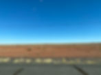
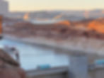
Scenery on the Navajo Nation in Arizona along route 89
- Deborah Kade
- Sep 3, 2020
- 9 min read
Updated: Jan 10, 2021
Today should be the first day of our yearly trip to Switzerland but due to COVID we had to change plans. So, we and the Tesla are off to Sun Valley, Idaho. Michael and I decided to slow down and enjoy the scenery along the way.
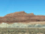
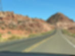
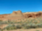
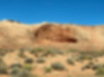
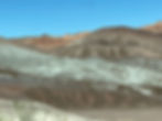
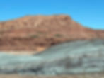
The scenery on the Navajo Nation is varied, unique and so very beautiful!!!!
"The Navajo Nation (Navajo: Naabeehó Bináhásdzo) is an American Indian territory covering about 17,544,500 acres (71,000 km2; 27,413 sq mi), occupying portions of northeastern Arizona, southeastern Utah, and northwestern New Mexico. This is the largest land area retained by an indigenous tribe in the United States, with a population of 173,667 as of 2010.

By area, the Navajo Nation is larger than ten U.S. states- West Virginia, Maryland, Hawaii, Massachusetts, Vermont, New Hampshire, New Jersey, Connecticut, Delaware and Rhode Island – and is less than one percent shy of being equal to the combined area of the last five (New Hampshire through Rhode Island)."
The Cameron Suspension Bridge
"The bridge formerly carried u.S. Route 89, but was replaced by a newer deck truss bridge in 1959. Built in 1911, it has an overall length of 680 feet (210 m) and a main span of 660 feet (200 m). The bridge was built by the Midland Bridge Company of Kansas City for the Office of Indian Affairs and the Indian Irrigation Service. W. H. Code of the Midland Bridge Company was the designer. The suspension design was chosen to address the steep-walled canyon at the crossing, which required a single span with no temporary falsework. When built, the Cameron bridge was the longest suspension span west of the Mississippi River."


"The bridge towers rest on the rim of the canyon, with concrete deadmen anchoring the suspension cables some way back from the towers. The deck is stiffened by a Pratt through-truss, with a 14-foot (4.3 m) wide roadway. The bridge was built to improve access to the Navajo Nation and the Hopi Indian Reservation. Named for U.S. Senator Ralph H. Cameron, it was an important link for the construction of the Navajo Bridge on US 89 across the Colorado River in 1929. The town of Cameron grew up around the crossing, which in addition to opening up the Native American lands to the north, also provided a northern gateway to the South Rim of the Grand Canyon when the Navajo Bridge opened.
The bridge was damaged by an overload of sheep in 1937, when it almost collapsed. The damage was repaired and the bridge served highway traffic until 1959. It was sold to the Four Corners Pipeline Company when the new bridge opened, and carries a natural gas pipeline. It is the oldest suspension bridge in Arizona, and one of only two of that type in the state.
The Cameron Suspension Bridge was added to the National Register of Historic Places on June 5, 1986."


Carries: Natural gas pipeline
Crosses: Little Colorado River
Locale: Cameron, Arizona,
Characteristics
Design: Suspension
Material: Steel
Total length: 680 feet (210 m)
Height: 14 feet (4.3 m)
Longest span: 660 feet (200 m)
History
Designer: W. H. Code
Opened:1911
Closed: 1959

The Navajo Nation is the largest Indian reservation in the United States.
"Much of the Navajo Nation is situated atop the Colorado Plateau. The large variation in altitude (3,080 feet (940 m) to 10,346 feet (3,153 m)) throughout the Navajo Nation is responsible for considerable variations in climate, from an arid, desert climate, comprising 55% of the area, an intermediate steppe region, and the cold, sub-humid climate of the mountainous 8%.


"Extensive uranium mining took place in areas of the Navajo Nation before environmental laws were passed or enforced on the control of hazardous wastes of such operations, or their fallout.
Studies have proven the unregulated practices created severe environmental consequences for people living nearby. Several types of cancer occur at much higher rates than the national average in these locations. Especially high are the rates of reproductive organ cancers in teenage Navajo girls, averaging seventeen times higher than the average of girls in the United States.
Residents of the Red Water Pond Road area have requested relocation to a new, off-grid village to be located on Standing Black Tree Mesa while cleanup progresses on the Northeast Church Rock Mine Superfund site, as an alternative to the EPA-proposed relocation of residents to Gallup."
"Natural resources
Mining – especially of coal and uranium provided significant income to both the Navajo Nation and individual Navajos in the second half of the 20th century. Many of these mines have closed. In the early 21st century, mining still provides significant revenues to the tribe in terms of leases (51% of all tribal income in 2003). Individual Navajos are part of the 1,000 people employed in mining.
Coal
The volume of coal mined on the Navajo Nation land has declined in the early 21st century. The Chevron Corporation's P&M McKinley Mine was the first large-scale surface coal mine in New Mexico when it opened in 1961. It closed in January 2010. Peabody Energy's Black Mesa coal mine, a controversial strip mine, was shut down in December 2005 because of its environmental impact and lost an appeal to reopen in January 2010.The Black Mesa mine fed the 1.5 GW Mohave Power Station at Laughlin, Nevada, via a slurry pipeline that used water from the Black Mesa aquifer. The nearby Kayenta Mine used the Black Mesa & Lake Powell Railroad to move coal to the former Navajo Generating Station (2.2 GW) at Page, Arizona.

The Kayenta Mine provided the majority of leased revenues for the tribe. The Kayenta mine also provided wages to those Navajos who were part of its 400 employees.
Uranium
The uranium market, which was active during and after the second World War, slowed near the end of that period. The Nation has suffered considerable environmental contamination and health effects as a result of poor regulation of uranium mining. As of 2005, the Navajo Nation has prohibited uranium mining altogether within its borders.
Oil and natural gas
There are developed and potential oil and gas fields on the Navajo Nation. The oldest and largest group of fields is in the Paradox Basin in the Four Corners area. Most of these fields are located in the Aneth Extension in Utah but there are a few wells in Colorado, New Mexico and Arizona. The first well was drilled in the Aneth Extension in 1956. In 2006 the Paradox Basin fields were injected with water and Co2 to increase declining production. There are also wells in the Checkerboard area in New Mexico that are on leased land owned by individual Navajos.
The selling of leases and oil royalties have changed over the years. The Aneth Extension was created from Public Domain lands as part a 1933 exchange for lands flooded by Lake Powell. Congress appointed Utah as trustee on behalf of Navajos living in San Juan County, Utah for any potential revenues that came from natural resources in the area. Utah initially created a 3-person committee to make leases, receive royalties and improve the living conditions for Utah Navajos. As the revenues and resulting expenditures increased, Utah created the 12 member Navajo Commission to do the operational work. The Navajo Nation and Bureau of Indian Affairs are also involved.
There are several Navajo organizations that deal with oil and gas. The Utah Diné Corporation is a nonprofit organization established to take over from the Navajo Commission. The Navajo Nation Oil and Gas Company owns and operates oil and natural gas interests primarily in New Mexico, Colorado, and Utah. Federally incorporated, it is wholly owned by the Navajo Nation.
Renewables
In early 2008, the Navajo Nation and Houston-based IPP entered into an agreement to monitor wind resources, with the potential to build a 500-megawatt wind farm some 50 miles (80 km) north of Flagstaff, Arizona. Known as the Navajo Wind Project, it is proposed as the second commercial wind farm in Arizona after Iberdrola's Dry Lake Wind Power Project between Holbrook and Overgaard-Heber. The project is to be built on Aubrey Cliffs in Coconino County, Arizona.
In December 2010, the President and Navajo Council approved a proposal by the NTUA, an enterprise of the Navajo Nation and Edison Mission Energy, to develop an 85-megawatt wind project at Big Boquillas Ranch, which is owned by the Navajo Nation and is located 80 miles west of Flagstaff. NTUA plans to develop this to a 200-megawatt capacity at peak. This has been planned as the first majority-owned native project; NTUS was to own 51%. An estimated 300–350 people will construct the facility; it will have 10 permanent jobs. In August 2011, the Salt River Project, an Arizona utility, was announced as the first utility customer. Permitting and negotiations involve tribal, federal, state and local stakeholders. The project is intended not only as a shift to renewable energy but to increase access for tribal members; an estimated 16,000 homes are without access to electricity.
The wind project has foundered because of a "long feud between Cameron [Chapter] and Window Rock [central government] over which company to back." Both companies pulled out. Negotiations with Clipper Windpower looked promising but that company was put up for sale after the recession."
The U.S. center hardest hit by COVID-19 isn't headline-grabbing New York City; it's the Navajo Nation in the American southwest.
"One big issue for the high rate is a lack of infrastructure that was a problem long before the new coronavirus appeared, said Dr. Sriram Shamasunder, an associate professor of medicine at the University of California, San Francisco. He is also the co-founder of UCSF's Health, Equity, Action, Leadership (HEAL) Initiative, which is partnering with the Navajo Nation to improve conditions.
Shamasunder said many Navajo Nation residents lack basic amenities that most Americans take for granted.
"I would say that one-third of the population doesn't have electricity or running water," he said, and "that means that while 'shelter-in-place' may for us be an inconvenience, for many Native Americans it's an impossibility. If you don't have a refrigerator to store food, or water to drink, then you're not going to be able to just stay at home."
Then there's hunger. A 2016 "Hunger Report" issued by the Bread for the World Institute noted that grocery stores, convenience stores and fresh produce are either hard to find or not affordable for many Navajo Nation residents, 44% of whom live below the poverty line. As a result, the U.S. Department of Agriculture has classified all of the Navajo Nation a "food desert."
There are cultural factors making the Navajo more vulnerable to COVID-19's spread, as well. Social distancing, for example, is an especially tough concept in this context.
"The Navajo have a very beautiful expansive definition of family, with many generations often living under one roof," Shamasunder said."


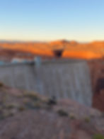
We wanted to visit Antelope Canyon and Horseshoe Bend which are located on the Indian reservation but both are closed as well as the tours for the Carl Hayden Dam in Page.

The Carl Hayden Visitor Center at Glen Canyon Dam is located on the west end of the dam, approximately 110 feet above its crest.
This beautiful, modernistic building whose circular, glass-enclosed east end juts out over the dam, provides a sweeping panoramic view of the dam and Lake Powell behind it.
A Fountain Memorial is dedicated to the 8 Bureau of Reclamation employees who died October 8, 1997 in a plane crash near Montrose, Colorado.


While crossing the Glen Canyon Dam from Arizona to Utah, we saw this on the car map. Aussichtpunkt means "lookout point in German. Really???


Glen Canyon Bridge, like many things in life, was born out of necessity, and it all started through an Act of Congress.

"On April 11, 1956 the U.S. Congress authorized the construction of Glen Canyon Dam to be located on the Colorado River approximately 17 miles north of Lee’s Ferry, Arizona and 12 miles south of the Arizona-Utah border.
In 1956, this location was pretty much in the middle of nowhere. There was no railroad here and the nearest towns of any size were Flagstaff, Arizona, 130 miles to the south, and Kanab, Utah, 73 miles to the north.
To further complicate things, there were no roads from the dam site to either of these towns and, there was no way across the deep chasm formed by the Colorado River.
So how can you build a dam where there are no roads and you have no way of getting from one side of the river to the next? You build roads and a bridge. Thus, Glen Canyon Bridge was born out of necessity.
In 1956, when the dam was authorized by Congress, US Highway 89 extended north from Flagstaff, Arizona to Bitter Springs, Arizona, a distance of approximately 106 miles.
The Bureau of Reclamation contracted for a road to be built from that point to the dam site, a distance of approximately 24 miles.
The Bureau of Roads was to build a temporary paved road from the west side of the dam site to the Arizona-Utah state line.
Then, the state of Utah would build a paved road from the Arizona-Utah state line to join Utah State Highway 136 at Kanab, Utah. Thus, there would now be a road all the way from Flagstaff, Arizona to Kanab, Utah.
Now that the problem of getting to the site had been resolved, there was still the obstacle of getting across the 1,300-feet chasm.
Until Reclamation could come up with a solution, the contractors were faced with a trip of more than 190 miles to get from one side of the canyon to the other.
When considering how to do this, Reclamation first looked at running the road over the dam itself. However, this presented some new problems:
The crest of the dam would be more than a hundred feet below the canyon rim. • The width of the crest of the dam was only 25 feet; potentially creating a traffic hazard. • The curvature of the dam presented further access problems. • Finally, the dam would have to be built first before the two roads could be linked.
For these reasons, Reclamation decided to build a separate bridge. But, then the question arose as to what kind of bridge should be built:
• A wooden suspension bridge to be used only for the construction of the dam at a cost of approximately $3,020,000, or • A permanent arch-type bridge with an estimated cost of $2,920,000.
Wisely, they decided on the second option.
The Glen Canyon Bridge was designed by Robert Sailer, who was the Head of the Bridge Section in Denver for the US Bureau of Reclamation."


What would a Kade vacation be without some food pictures??!!
We ate at Big John's Texas BBQ.
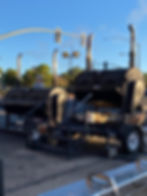

Michael had the sampler with ribs, sausage, brisket and pulled pork. I had the ribs and a garden salad. This is before he put on the sauce. The hot sauce was very very hot and the regular sauce had just the right tang.
